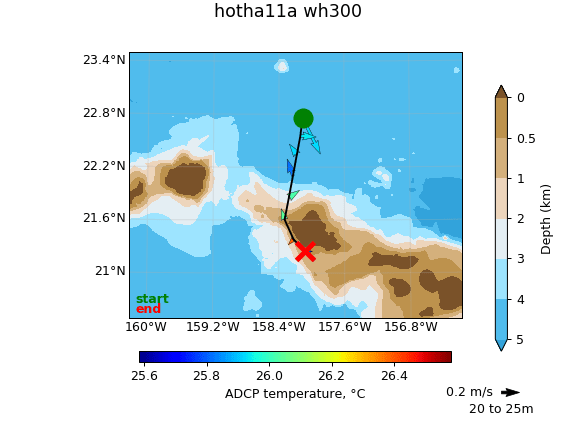
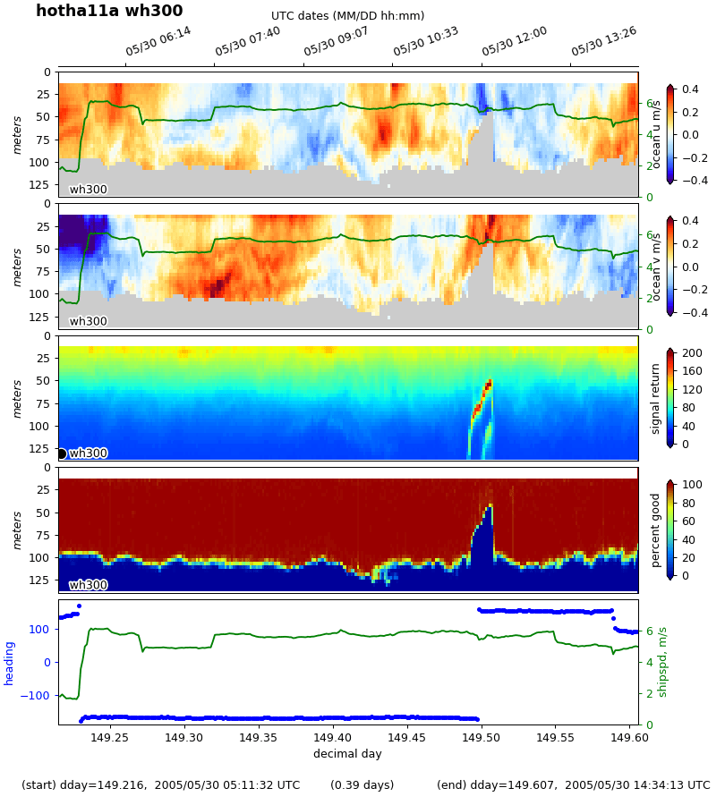
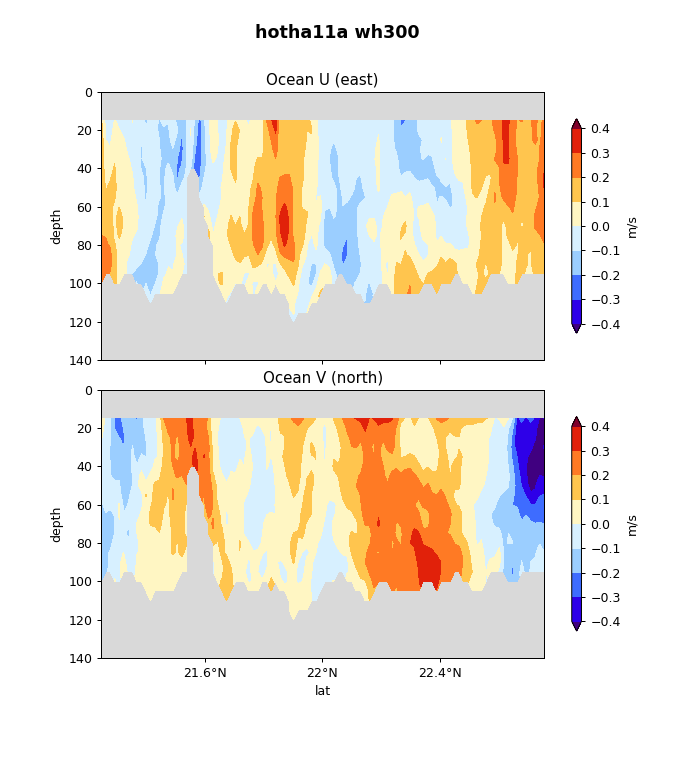
Station Aloha Shipboard ADCP data
As part of the hydrographic (WOCE) component of the Hawaii Ocean Time Series ( HOT ) Program, a hull-mounted Acoustic Doppler Current Profiler (ADCP) is used to measure the velocity of upper-ocean currents below the ship, both when on station and underway. Velocity data for these cruises are available from the NODC Joint Archive for Shipboard ADCP (JASADCP)
Links to vector and contour plots of the velocity data in png
format are provided below for recent cruises. Selecting "examine data"
will access an image map of the cruise track. Selection of any of the
labeled sections, by clicking on the letter, will show a vector plot
of upper ocean velocities over topography, with temperatures
color-coded on the vectors. Contour plots of both zonal and meridional
velocity versus depth and the appropriate horizontal dimension are
accessible from the vector plots. These plots display shaded velocity
values between +/- 100 cm s-1 typically, with divisions at
+/- 10 cm s-1. Positive and negative values are demarcated
with a black line.
Links to plots of the velocity data for 1997, 1998, and 1999 cruises (in gif and postscript formats) are provided below. Velocity fields at Station ALOHA and on the transits to and from ALOHA are presented.
![]() |
Velocity fields at Station ALOHA The top panel shows hourly averages at 20-m depth intervals while the ship was on station. The orientation of each stick gives the direction of the current: up is northward, to the right is eastward; the length gives the magnitude. The bottom panel shows the results of a least-squares fit of hourly averages to a mean, trend, semidiurnal and diurnal tides; the on-station time series were not long enough to fit an inertial cycle. In the first column, the arrow shows the mean current, the headless stick shows the sum of the mean plus the trend at the end of the station. For each harmonic, the current ellipse is shown in the first column. The orientation of the stick in the second column shows the direction of that harmonic component of the current at the beginning of the station, and the arrowhead at the end of the stick shows the direction of rotation of the current vector around the ellipse. |
![]() |
Velocity fields on the transits to and from Station ALOHA, HALE, and
ALOHA CLIMAX.
Velocity is shown as a function of latitude, averaged in 10-minute time intervals. The top panel shows velocity on the transit to Station ALOHA; the bottom panel shows the return trip. |
These data were processed at the University of Hawaii with support from NSF (OCE8717195, OCE9303094, OCE9811921, and OCE9819517).
Questions or comments should be directed to the local webmaster.